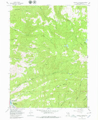
1967 Map of Crandall Canyon
USGS Topo · Published 1979About this map
Rockport State Park and the Weber River anchor the southwest corner of this Summit County landscape, where the Rockport Lake Spillway marks a significant point of water management and recreation. The terrain rises sharply from the river valley toward the Elkhorn Divide, a high ridge that separates numerous drainages including Crandall Canyon, Pecks Canyon, and Cottonwood Canyon. High-altitude water features like Elkhorn Reservoir and the Sargent Lakes are tucked into the upper reaches of the canyons, accessible by several noted Jeep Trails. This map details a high-country environment defined by its watershed, from the prominent Big Piney Mountain to the southern Base Line boundary. Ranching and land management activity is evident through the placement of multiple corrals and a water tank near Maple Ridge.
Find a feature on this map
28 named features on this map. Tap any name to fly to it.
Don’t see what you’re looking for? This feature index may not catch every label — zoom into the map to look around manually.
Map Details
Editions of this 1967 Crandall Canyon Map
2 editions found
Other maps of this area

1885 · Salt Lake
USGS Topo · 1:250,000

1900 · Coalville
USGS Topo · 1:125,000

1903 · Coalville
USGS Topo · 1:125,000

1954 · Salt Lake City
USGS Topo · 1:250,000

1955 · Park City East
USGS Topo · 1:24,000

1958 · Salt Lake City
USGS Topo · 1:250,000

1960 · Salt Lake City
USGS Topo · 1:250,000
1967 · Turner Hollow
USGS Topo · 1:24,000

1967 · Kamas
USGS Topo · 1:24,000
1967 · Wanship
USGS Topo · 1:24,000