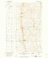
1958 Map of Crandall
USGS Topo · Published 1960About this map
Crandall stands as the primary rail settlement in this 1950s landscape, situated at a junction where the And St Louis railroad cuts through the glacial prairie. This map documents a transitional period for rural infrastructure in Day County, where the grid-like organization of townships like Minneapolis and Warren is punctuated by the last vestiges of a localized country school system, including School No 224 and School No 4. The terrain is characterized by the complex drainage patterns of Oak Gulch and the significant basin of Sweetwater Lake. To the north, the township of Scotland exhibits the characteristic pothole lake topography of the Dakotas, while scattered Gravel Pits indicate local resource extraction. Genealogists can find specific burial sites at the Crandall Cem and another unlabelled Cem, providing a detailed view of the community's footprint before later 20th-century consolidation.
Find a feature on this map
19 named features on this map. Tap any name to fly to it.
Don’t see what you’re looking for? This feature index may not catch every label — zoom into the map to look around manually.
Map Details
Editions of this 1958 Crandall Map
This is the sole edition of this map. No revisions or reprints were ever made.
Other maps of this area

1894 · Conde
USGS Topo · 1:62,500

1895 · Aberdeen
USGS Topo · 1:125,000

1953 · Milbank
USGS Topo · 1:250,000

1954 · Ferney
USGS Topo · 1:24,000

1954 · Aberdeen
USGS Topo · 1:250,000

1956 · Aberdeen
USGS Topo · 1:250,000

1958 · Milbank
USGS Topo · 1:250,000
1958 · Conde
USGS Topo · 1:24,000

1958 · Andover SW
USGS Topo · 1:24,000
1960 · Turton
USGS Topo · 1:24,000