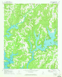
1969 Map of Crane Hill
USGS Topo · Published 1973About this map
Lewis Smith Lake dominates the landscape of western Cullman County, its deep fingers reaching into the surrounding hill country along Crooked Creek and Ryan Creek. This late-1960s survey illustrates a rural community shaped by the reservoir's creation, showing how water transformed the drainages of Lick Creek and Pigeon Roost Creek. Small inland settlements such as Crane Hill and Brushy Pond serve as local centers, while the western edge of the map enters the William B Bankhead National Forest. The map is particularly rich in genealogical data, documenting numerous rural congregations such as Antioch Ch, Livingston Chapel, and Bethany Ch. Educational hubs like Dowling Jr High Sch and crossroads hamlets like Guthery Crossroads and Trade highlight the mid-century social infrastructure of these Alabama highlands.
Find a feature on this map
47 named features on this map. Tap any name to fly to it.
Don’t see what you’re looking for? This feature index may not catch every label — zoom into the map to look around manually.
Map Details
Editions of this 1969 Crane Hill Map
3 editions found
Other maps of this area

1888 · Cullman
USGS Topo · 1:125,000

1889 · Birmingham
USGS Topo · 1:125,000

1892 · Cullman
USGS Topo · 1:125,000

1892 · Birmingham
USGS Topo · 1:125,000

1893 · Jasper
USGS Topo · 1:125,000

1895 · Birmingham
USGS Topo · 1:125,000

1907 · Birmingham
USGS Topo · 1:125,000

1949 · Cold Springs
USGS Topo · 1:24,000

1949 · Sunlight
USGS Topo · 1:24,000

1951 · Cold Springs
USGS Topo · 1:24,000