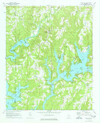
1969 Map of Crane Hill
USGS Topo · Published 1978About this map
The fingers of Lewis Smith Lake define the geography of this western Cullman County landscape, as mapped in the late 1960s. The intricate shoreline of the reservoir reaches deep into the valleys once carved by Crooked Creek, Ryan Creek, and Lick Creek, creating distinctive landmarks like Muscadine Point and Miller Bottom. This period represents the era following the reservoir's creation, where established inland communities like Crane Hill and Brushy Pond find themselves adjacent to a transformed hydraulic landscape.
Find a feature on this map
49 named features on this map. Tap any name to fly to it.
Don’t see what you’re looking for? This feature index may not catch every label — zoom into the map to look around manually.
Map Details
Editions of this 1969 Crane Hill Map
3 editions found
Other maps of this area

1888 · Cullman
USGS Topo · 1:125,000

1889 · Birmingham
USGS Topo · 1:125,000

1892 · Cullman
USGS Topo · 1:125,000

1892 · Birmingham
USGS Topo · 1:125,000

1893 · Jasper
USGS Topo · 1:125,000

1895 · Birmingham
USGS Topo · 1:125,000

1907 · Birmingham
USGS Topo · 1:125,000

1949 · Cold Springs
USGS Topo · 1:24,000

1949 · Sunlight
USGS Topo · 1:24,000

1951 · Cold Springs
USGS Topo · 1:24,000