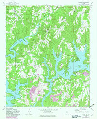
1969 Map of Crane Hill
USGS Topo · Published 1983About this map
The deep, branching inlets of Lewis Smith Lake dominate the landscape of Cullman and Winston counties in the late 1960s, winding through the timbered ridges of the William B Bankhead National Forest. This era shows a community defined by its proximity to the water, where the rugged topography of Pigeon Roost Ridge and Davis Ridge separates the creek valleys that feed the reservoir. Local life centers on rural crossroads and small farming settlements like Crane Hill and Wheat. Genealogy researchers can find numerous country congregations, including Bethany Ch and Harmony Ch, alongside the Dowling Jr High Sch. The map also captures the varied shoreline features such as Muscadine Point and Miller Bottom, illustrating the transition of these valleys from river-bottom lands to a major recreational and hydroelectric resource.
Find a feature on this map
45 named features on this map. Tap any name to fly to it.
Don’t see what you’re looking for? This feature index may not catch every label — zoom into the map to look around manually.
Map Details
Editions of this 1969 Crane Hill Map
3 editions found
Other maps of this area

1888 · Cullman
USGS Topo · 1:125,000

1889 · Birmingham
USGS Topo · 1:125,000

1892 · Cullman
USGS Topo · 1:125,000

1892 · Birmingham
USGS Topo · 1:125,000

1893 · Jasper
USGS Topo · 1:125,000

1895 · Birmingham
USGS Topo · 1:125,000

1907 · Birmingham
USGS Topo · 1:125,000

1949 · Cold Springs
USGS Topo · 1:24,000

1949 · Sunlight
USGS Topo · 1:24,000

1951 · Cold Springs
USGS Topo · 1:24,000