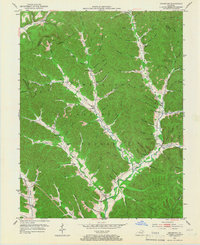
1951 Map of Cranston
USGS Topo · Published 1967About this map
Cumberland National Forest defines the landscape of Rowan County, Kentucky, in the early 1950s, where small settlements are tucked into the valleys of the North Fork Triplett Creek. The community of Cranston sits at a crossroads near the southern edge of the sheet, while other hamlets like Smile, Waltz, and Whisman serve as local anchors. The map reveals a high density of rural institutions essential to mid-century Appalachian life, including Island Fork Sch and the Adams-Davis Sch.
Find a feature on this map
95 named features on this map. Tap any name to fly to it.
Don’t see what you’re looking for? This feature index may not catch every label — zoom into the map to look around manually.
Map Details
Editions of this 1951 Cranston Map
2 editions found
Other maps of this area

1929 · Morehead
USGS Topo · 1:48,000

1929 · Salt Lick
USGS Topo · 1:62,500

1934 · Salt Lick
USGS Topo · 1:62,500

1935 · Morehead
USGS Topo · 1:62,500

1950 · Head Of Grassy
USGS Topo · 1:24,000

1951 · Soldier
USGS Topo · 1:24,000

1951 · Cranston
USGS Topo · 1:24,000

1951 · Stricklett
USGS Topo · 1:24,000

1951 · Plummers Landing
USGS Topo · 1:24,000

1951 · Burtonville
USGS Topo · 1:24,000