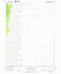
1967 Map of Crater Island SW
USGS Topo · Published 1979About this map
The eastern slopes of the Pilot Range descend into a vast expanse of Alkali Or Mud flats in this 1967 topographic study of the Utah desert. The landscape is defined by its scarce water sources, notably Donner Spring and South Patterson Spring, which serve as vital landmarks along the base of the mountains. The presence of the Donner Reed Trail cutting across the southern portion of the map provides a tangible link to the mid-19th-century overland migration routes, following the edge of the salt flats. Along the mountain front, several unnamed Springs and the seasonal Bettridge Creek illustrate the drainage patterns that disappear into the basin. This survey captures the transition from the high ridges of the range down through shifting Sand Dunes to the level, mud-cracked floor of the Great Salt Lake Desert, spanning the border of Box Elder and Tooele Counties.
Find a feature on this map
12 named features on this map. Tap any name to fly to it.
Don’t see what you’re looking for? This feature index may not catch every label — zoom into the map to look around manually.
Map Details
Editions of this 1967 Crater Island SW Map
2 editions found
Other maps of this area

1953 · Tooele
USGS Topo · 1:250,000

1954 · Brigham City
USGS Topo · 1:250,000

1955 · Tooele
USGS Topo · 1:250,000

1955 · Wells
USGS Topo · 1:250,000

1955 · Elko
USGS Topo · 1:250,000

1958 · Wells
USGS Topo · 1:250,000

1958 · Elko
USGS Topo · 1:250,000

1958 · Brigham City
USGS Topo · 1:250,000

1961 · Wells
USGS Topo · 1:250,000

1962 · Elko
USGS Topo · 1:250,000