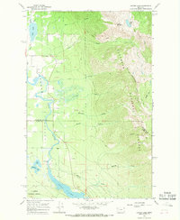
1964 Map of Crater Lake
USGS Topo · Published 1968About this map
The Swan River winds through the floor of the Flathead Valley in this mid-1960s survey, marking the transition from lowland waters to the high terrain of the Flathead National Forest. This landscape is defined by its drainage network, where the river feeds into the northern reaches of Swan Lake near several small water bodies including Loon Lake, Horseshoe Lake, and Mud Lake. The map details a primitive transportation network consisting largely of pack trails that ascend the steep eastern ridges, providing access to remote summits like Crater Mountain and Broken Leg Mountain.
Find a feature on this map
29 named features on this map. Tap any name to fly to it.
Don’t see what you’re looking for? This feature index may not catch every label — zoom into the map to look around manually.
Map Details
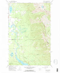
Editions of this 1964 Crater Lake Map
2 editions found
Other maps of this area

1914 · Nyack
USGS Topo · 1:125,000

1920 · Flathead Lake
USGS Topo · 1:125,000

1943 · Kalispell
USGS Topo · 1:125,000

1955 · Choteau
USGS Topo · 1:250,000

1956 · Wallace
USGS Topo · 1:250,000

1957 · Choteau
USGS Topo · 1:250,000

1957 · Kalispell
USGS Topo · 1:250,000

1958 · Choteau
USGS Topo · 1:250,000

1960 · Kalispell
USGS Topo · 1:250,000

1960 · Wallace
USGS Topo · 1:250,000