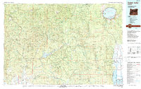
1989 Map of Crater Lake
USGS Topo · Published 1990About this map
Crater Lake dominates the northeast quadrant of this landscape, its waters punctuated by Wizard Island and the jagged Phantom Ship. This 1989 compilation details the complex hydraulic and forested systems of the Cascade Range, showing the Rogue River flowing southwest through Cascade Gorge and into Lost Creek Lake. The map reveals a region defined by federal management and industrial extraction, with the Umpqua National Forest and Rogue River National Forest bordering the Rogue-Umpqua Divide Wilderness. In the settled areas, small communities like Prospect and Butte Falls serve as hubs for the local timber and hydroelectric economies, while the Cinnabar Mine and a network of aqueducts point to the area's geological and resource history. For those interested in recreation, Joseph Stewart State Park and Casey State Park are clearly marked along the river corridors.
Find a feature on this map
60 named features on this map. Tap any name to fly to it.
Don’t see what you’re looking for? This feature index may not catch every label — zoom into the map to look around manually.
Map Details
Editions of this 1989 Crater Lake Map
This is the sole edition of this map. No revisions or reprints were ever made.
Other maps of this area

1889 · Klamath
USGS Topo · 1:250,000

1891 · Ashland
USGS Topo · 1:250,000

1893 · Ashland
USGS Topo · 1:250,000

1894 · Klamath
USGS Topo · 1:250,000

1897 · Roseburg
USGS Topo · 1:125,000

1897 · Ashland
USGS Topo · 1:250,000

1900 · Roseburg
USGS Topo · 1:125,000

1904 · Riddle
USGS Topo · 1:125,000

1908 · Grants Pass
USGS Topo · 1:125,000

1917 · Diamond Lake
USGS Topo · 1:125,000