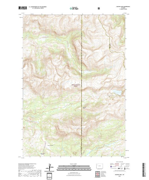
2021 Map of Crater Lake
USGS Topo · Published 2021About this map
Teton National Forest encompasses this high-altitude landscape where the headwaters of the Buffalo Fork drainage take shape. The terrain is defined by the steep slopes of the Absaroka Range, with Soda Mtn and Smokehouse Mtn rising above the timberline. Waterways are the primary geographic anchors here, with the North Buffalo Fork and Soda Fork carving through deep valleys. These rivers form part of the Snake River Headwaters Wild and Scenic River system, a designation that emphasizes the preservation of the area's natural state.
Find a feature on this map
25 named features on this map. Tap any name to fly to it.
Don’t see what you’re looking for? This feature index may not catch every label — zoom into the map to look around manually.
Map Details
Editions of this 2021 Crater Lake Map
This is the sole edition of this map. No revisions or reprints were ever made.
Other maps of this area

1885 · Lake
USGS Topo · 1:125,000

1893 · Ishawooa
USGS Topo · 1:125,000

1895 · Ishawooa
USGS Topo · 1:125,000

1895 · Lake
USGS Topo · 1:125,000

1896 · Lake
USGS Topo · 1:125,000

1899 · Ishawooa
USGS Topo · 1:125,000

1901 · Lake
USGS Topo · 1:125,000

1902 · Mt Leidy
USGS Topo · 1:125,000

1905 · Younts Peak
USGS Topo · 1:125,000

1906 · Lake
USGS Topo · 1:125,000