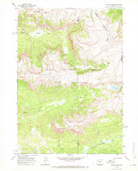
1968 Map of Crater Lake
USGS Topo · Published 1971About this map
The Continental Divide winds through this high-altitude landscape in the Teton Wilderness, marking the separation of river systems within the Teton National Forest. This 1968 field-checked survey reveals a territory defined by its hydrological network, where the North Fork Buffalo Fork and South Buffalo Fork drain significant drainages. The terrain is dominated by prominent summits including Soda Mountain and Smokehouse Mountain.
Find a feature on this map
25 named features on this map. Tap any name to fly to it.
Don’t see what you’re looking for? This feature index may not catch every label — zoom into the map to look around manually.
Map Details
Editions of this 1968 Crater Lake Map
This is the sole edition of this map. No revisions or reprints were ever made.
Other maps of this area

1885 · Lake
USGS Topo · 1:125,000

1893 · Ishawooa
USGS Topo · 1:125,000

1895 · Ishawooa
USGS Topo · 1:125,000

1895 · Lake
USGS Topo · 1:125,000

1896 · Lake
USGS Topo · 1:125,000

1899 · Ishawooa
USGS Topo · 1:125,000

1901 · Lake
USGS Topo · 1:125,000

1902 · Mt Leidy
USGS Topo · 1:125,000

1905 · Younts Peak
USGS Topo · 1:125,000

1906 · Lake
USGS Topo · 1:125,000