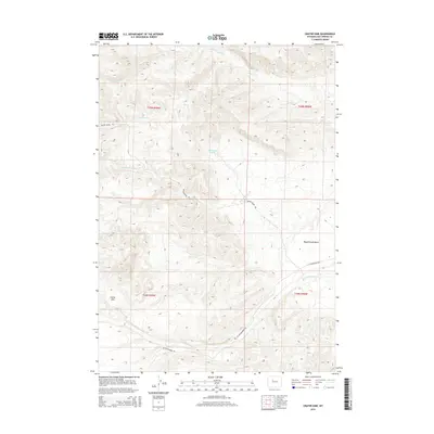
2015 Map of Crater Sink
USGS Topo · Published 2015About this map
Crater Sink defines the southwestern corner of this high-altitude landscape in Hot Springs County, where the terrain is marked by a complex network of seasonal drainages and topographic benches. The drainage patterns of Little Prospect Cr and Prospect Cr flow across the northern sections, while Wagonhound Cr cuts through the center of the quadrangle. This area of Wyoming is characterized by its significant elevation changes, notably visualized at Wagonhound Bench and the various ridges that separate the primary watercourses.
Find a feature on this map
13 named features on this map. Tap any name to fly to it.
Don’t see what you’re looking for? This feature index may not catch every label — zoom into the map to look around manually.
Map Details
Editions of this 2015 Crater Sink Map
This is the sole edition of this map. No revisions or reprints were ever made.
Other maps of this area

1913 · Grass Creek Basin
USGS Topo · 1:62,500

1915 · Grass Creek Basin
USGS Topo · 1:62,500

1955 · Thermopolis
USGS Topo · 1:250,000

1956 · Twentyone Creek
USGS Topo · 1:24,000

1956 · Adam Weiss Peak
USGS Topo · 1:24,000

1958 · Thermopolis
USGS Topo · 1:250,000

1962 · Thermopolis
USGS Topo · 1:250,000

1965 · Arapahoe Ranch
USGS Topo · 1:24,000
1965 · Embar
USGS Topo · 1:24,000
1965 · Anchor Reservoir
USGS Topo · 1:24,000