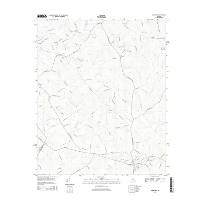
2014 Map of Crawford
USGS Topo · Published 2014About this map
Crawford serves as the primary hub of this Oglethorpe County landscape, where the confluence of agriculture and local hydrology defines the settlement pattern. The town sits at the intersection of several historic routes, including Athens Rd and Arnoldsville Rd, reflecting its role as a regional connector. The terrain is deeply etched by a dense network of waterways, with Big Clouds Creek and Mill Creek carving through the Piedmont soil. A significant cultural landmark, Howards Covered Bridge, spans the northeastern corner of the map, while numerous small family and community burial grounds like the Randolph Tucker Cem and Beaverdam Cem are scattered throughout the rural acreage. The mapping of infrastructure like Dam Number 65 and reservoirs such as Lake George suggests a landscape managed for both water resources and agricultural sustainability in the early 21st century.
Find a feature on this map
122 named features on this map. Tap any name to fly to it.
Don’t see what you’re looking for? This feature index may not catch every label — zoom into the map to look around manually.
Map Details
Editions of this 2014 Crawford Map
This is the sole edition of this map. No revisions or reprints were ever made.
Other maps of this area

1891 · Carnesville
USGS Topo · 1:125,000

1953 · Athens
USGS Topo · 1:250,000

1954 · Greenville
USGS Topo · 1:250,000

1958 · Greenville
USGS Topo · 1:250,000

1958 · Athens
USGS Topo · 1:250,000

1958 · Danielsville
USGS Topo · 1:62,500

1959 · Athens
USGS Topo · 1:250,000

1963 · Athens
USGS Topo · 1:250,000

1964 · Barnett Shoals
USGS Topo · 1:24,000

1964 · Hull
USGS Topo · 1:24,000