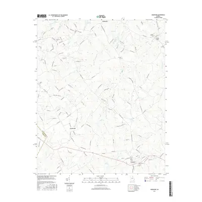
2017 Map of Crawford
USGS Topo · Published 2017About this map
Smithonia, Arnoldsville, and Crawford form a triangle of rural settlements across the Oglethorpe County landscape, defined by a network of creeks and small family cemeteries. The terrain is deeply etched by watercourses such as Hawks Cr, Big Clouds Cr, and Goulding Cr, which feed into larger bodies like Lake George and Beaver Dam Lake. A notable landmark for local historians is the Howards Covered Bridge, situated in the northeastern corner near the Martin Cem. The map reveals a dense distribution of ancestral burial grounds, including the Mathews Cem, Beaverdam Cem, and Randolph Tucker Cem, providing a clear record of local family lineages. The boundary between Oglethorpe County and Clarke County runs through the southwestern section, marking the rural edge of the region.
Find a feature on this map
131 named features on this map. Tap any name to fly to it.
Don’t see what you’re looking for? This feature index may not catch every label — zoom into the map to look around manually.
Map Details
Editions of this 2017 Crawford Map
This is the sole edition of this map. No revisions or reprints were ever made.
Other maps of this area

1891 · Carnesville
USGS Topo · 1:125,000

1953 · Athens
USGS Topo · 1:250,000

1954 · Greenville
USGS Topo · 1:250,000

1958 · Greenville
USGS Topo · 1:250,000

1958 · Athens
USGS Topo · 1:250,000

1958 · Danielsville
USGS Topo · 1:62,500

1959 · Athens
USGS Topo · 1:250,000

1963 · Athens
USGS Topo · 1:250,000

1964 · Barnett Shoals
USGS Topo · 1:24,000

1964 · Hull
USGS Topo · 1:24,000