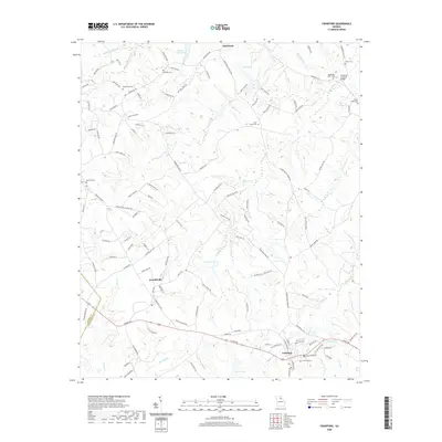
2020 Map of Crawford
USGS Topo · Published 2020About this map
The settlement of Smithonia anchors the northern portion of this Oglethorpe County landscape, where the terrain is defined by the winding paths of Big Clouds Cr and Beaverdam Cr. A notable landmark is Howards Covered Bridge, situated near the confluence of local streams in the northeast corner. The map reflects a blend of rural heritage and established communities like Arnoldsville and the town of Crawford, which sits along the southern edge. Numerous family and community burial grounds, including Randolph Tucker Cem and Mathews Cem, are scattered across the quadrangle, serving as vital points of interest for genealogists and local historians. The area is also marked by modern water management features such as Dam Number 65 and Lake George, illustrating the long-term human modification of the local hydrology for agriculture and development.
Find a feature on this map
126 named features on this map. Tap any name to fly to it.
Don’t see what you’re looking for? This feature index may not catch every label — zoom into the map to look around manually.
Map Details
Editions of this 2020 Crawford Map
This is the sole edition of this map. No revisions or reprints were ever made.
Other maps of this area

1891 · Carnesville
USGS Topo · 1:125,000

1953 · Athens
USGS Topo · 1:250,000

1954 · Greenville
USGS Topo · 1:250,000

1958 · Greenville
USGS Topo · 1:250,000

1958 · Athens
USGS Topo · 1:250,000

1958 · Danielsville
USGS Topo · 1:62,500

1959 · Athens
USGS Topo · 1:250,000

1963 · Athens
USGS Topo · 1:250,000

1964 · Barnett Shoals
USGS Topo · 1:24,000

1964 · Hull
USGS Topo · 1:24,000