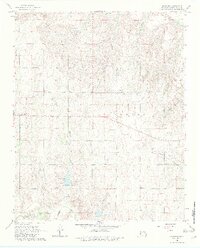
1965 Map of Crawford
USGS Topo · Published 1982About this map
Crawford serves as a central point of reference in this mid-1960s survey of Roger Mills County. The landscape is defined by the drainage systems of the Washita River and several of its tributaries, including Dead Indian Creek, Dugout Creek, and Spring Creek. The topography around Twin Hills reflects the transition between upland plateaus and the more dissected river valleys. Cultural landmarks of particular interest for local history include the United Pentecostal Ch and Sunrise Cem. The presence of an Oil Well and the development of Spring Creek Lake highlight the intersection of natural resource utilization and land management in the mid-20th century, while the map also preserves the alignments of numerous rural fence and field lines that shaped the agricultural layout of the time.
Find a feature on this map
13 named features on this map. Tap any name to fly to it.
Don’t see what you’re looking for? This feature index may not catch every label — zoom into the map to look around manually.
Map Details
Editions of this 1965 Crawford Map
2 editions found
Other maps of this area

1955 · Clinton
USGS Topo · 1:250,000

1957 · Clinton
USGS Topo · 1:250,000

1960 · Cheyenne
USGS Topo · 1:62,500

1961 · Reydon
USGS Topo · 1:62,500

1965 · Roll NW
USGS Topo · 1:24,000

1965 · Crawford
USGS Topo · 1:24,000

1966 · Roll
USGS Topo · 1:24,000

1966 · Antelope Hills NE
USGS Topo · 1:24,000

1966 · Antelope Hills
USGS Topo · 1:24,000

1966 · Durham
USGS Topo · 1:24,000