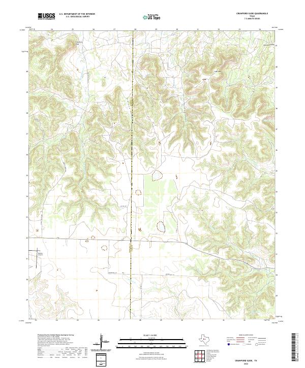
2022 Map of Crawford Slide
USGS Topo · Published 2022About this map
Crawford Slide anchors this high-elevation landscape along the Sterling Co Coke Co boundary, where a network of ephemeral watercourses and deep canyons defines the local geography. The area is characterized by significant topographic relief, most notably at Goat Mtn and within the rugged depths of Pierce Canyon and Grubs Canyon. A specialized transportation and settlement pattern is evident through the presence of Bodine Airport and remote rural roads such as Knight Canyon Rd and Mendenhall Ln. Water sources, critical in this West Texas environment, are marked by named drainages like S Gasconades Cr, Pecan Cr, and Kates Cr, along with the secluded Cosby Spring. The naming of Cemetery Draw suggests localized history and early land use often sought by genealogists researching family ties in the canyons of Coke County.
Find a feature on this map
21 named features on this map. Tap any name to fly to it.
Don’t see what you’re looking for? This feature index may not catch every label — zoom into the map to look around manually.
Map Details
Editions of this 2022 Crawford Slide Map
This is the sole edition of this map. No revisions or reprints were ever made.
Other maps of this area

1954 · Big Spring
USGS Topo · 1:250,000

1954 · San Angelo
USGS Topo · 1:250,000

1958 · San Angelo
USGS Topo · 1:250,000

1958 · Big Spring
USGS Topo · 1:250,000

1959 · Silver
USGS Topo · 1:24,000

1959 · McWhorter Mountain
USGS Topo · 1:24,000

1959 · Dead Indian Mountain
USGS Topo · 1:24,000

1962 · Green Mountain
USGS Topo · 1:24,000

1965 · San Angelo
USGS Topo · 1:250,000

1972 · Sterling City
USGS Topo · 1:24,000