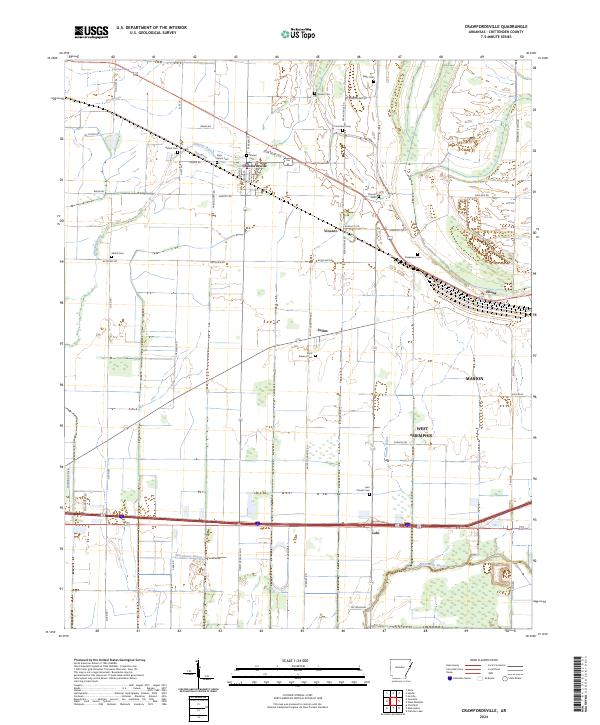
2024 Map of Crawfordsville
USGS Topo · Published 2024About this map
Crawfordsville sits as a primary hub within this modern landscape of Crittenden County, defined by a dense network of agricultural drainage and family-named landmarks. The terrain is crisscrossed by a complex hydrographic system including Dry Bayou, Alligator Bayou, and the prominent Fifteenmile Bayou to the south. This survey reveals a high concentration of small, localized burial sites which provide significant value for genealogical research, such as Saint Johns Cem, Bethel Cem, and the Lehi Church Cem.
Find a feature on this map
59 named features on this map. Tap any name to fly to it.
Don’t see what you’re looking for? This feature index may not catch every label — zoom into the map to look around manually.
Map Details
Editions of this 2024 Crawfordsville Map
This is the sole edition of this map. No revisions or reprints were ever made.
Other maps of this area

1916 · Memphis
USGS Topo · 1:62,500

1925 · Memphis
USGS Topo · 1:48,000

1927 · Memphis
USGS Topo · 1:62,500

1931 · Jericho
USGS Topo · 1:62,500

1939 · Jericho
USGS Topo · 1:62,500

1939 · Edmondson
USGS Topo · 1:62,500

1939 · Memphis
USGS Topo · 1:62,500

1940 · Deckerville
USGS Topo · 1:62,500

1952 · Jericho
USGS Topo · 1:62,500

1953 · Memphis
USGS Topo · 1:250,000