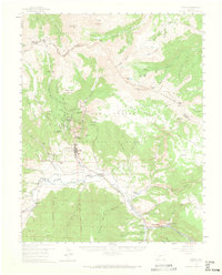
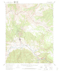
1959 Map of Creede
USGS Topo · Published 1965About this map
Mining history dominates this high-altitude landscape along the upper Rio Grande as mapped in 1959. The silver-mining legacy is etched into the steep terrain north of Creede, where deep-cut canyons hold legendary claims including the Amethyst Mine, Holy Moses Mine, and Commodore Mine. The settlement of North Creede sits tucked between Mammoth Mountain and Bulldog Mtn, illustrating the era's concentrated industrial development in the narrow gulches. An early aviation presence is noted at the Creede Airstrip, while the Denver and Rio Grande Western railroad tracks follow the river's path, connecting the remote district to broader markets.
Find a feature on this map
67 named features on this map. Tap any name to fly to it.
Don’t see what you’re looking for? This feature index may not catch every label — zoom into the map to look around manually.
Map Details
Editions of this 1959 Creede Map
6 editions found

Other maps of this area

1905 · San Cristobal
USGS Topo · 1:125,000

1907 · San Cristobal
USGS Topo · 1:125,000

1908 · Uncompahgre
USGS Topo · 1:125,000

1911 · Uncompahgre
USGS Topo · 1:125,000

1914 · Creede
USGS Topo · 1:125,000

1916 · Creede
USGS Topo · 1:125,000

1945 · Durango
USGS Topo · 1:250,000

1953 · Durango
USGS Topo · 1:250,000

1954 · Durango
USGS Topo · 1:250,000

1956 · Montrose
USGS Topo · 1:250,000