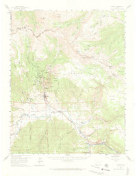
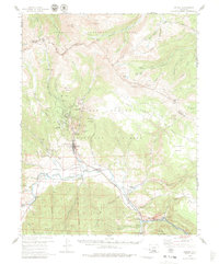
1959 Map of Creede
USGS Topo · Published 1973About this map
Creede sits at the heart of this late-1950s survey, a silver mining center defined by its vertical landscape and rail connections. The Denver and Rio Grande Western RR follows the Rio Grande through the valley floor, serving remote stops like Wagon Wheel Gap and the Wason Ranch. To the north, the terrain rises sharply toward the La Garita Mountains and the Continental Divide Boundary Trail, where industrial activity is concentrated along the narrow gulches. The map documents a dense network of hard-rock operations including the Amethyst Mine, Commodore Mine, and Equity Mine, many situated near North Creede. This landscape illustrates the transition between heavy extractive industry and the high-altitude wilderness of the Rio Grande National Forest and Gunnison National Forest. Rural infrastructure is further represented by Fremont Sch No 1 and the Creede Cem.
Find a feature on this map
67 named features on this map. Tap any name to fly to it.
Don’t see what you’re looking for? This feature index may not catch every label — zoom into the map to look around manually.
Map Details
Editions of this 1959 Creede Map
6 editions found

Other maps of this area

1905 · San Cristobal
USGS Topo · 1:125,000

1907 · San Cristobal
USGS Topo · 1:125,000

1908 · Uncompahgre
USGS Topo · 1:125,000

1911 · Uncompahgre
USGS Topo · 1:125,000

1914 · Creede
USGS Topo · 1:125,000

1916 · Creede
USGS Topo · 1:125,000

1945 · Durango
USGS Topo · 1:250,000

1953 · Durango
USGS Topo · 1:250,000

1954 · Durango
USGS Topo · 1:250,000

1956 · Montrose
USGS Topo · 1:250,000