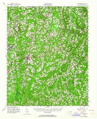
1943 Map of Creedmoor
USGS Topo · Published 1964About this map
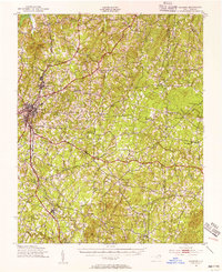
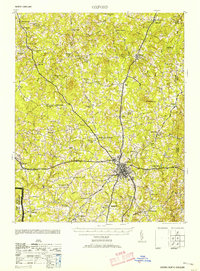
Camp Butner Military Reservation dominates the western landscape of this mid-century survey, reflecting the significant wartime infrastructure established in Granville County. The Seaboard Air Line railway serves as a primary transit corridor, connecting the town of Creedmoor with smaller outposts like Hester and Lyons. The terrain is defined by the winding course of the Tar River and Knap of Reeds Creek, which carve through a region densely populated with rural institutions.
Find a feature on this map
59 named features on this map. Tap any name to fly to it.
Don’t see what you’re looking for? This feature index may not catch every label — zoom into the map to look around manually.
Map Details
Editions of this 1943 Creedmoor Map
2 editions found
Other maps of this area

1943 · Durham South
USGS Topo · 1:62,500

1943 · Raleigh
USGS Topo · 1:62,500
1943 · Roxboro
USGS Topo · 1:62,500

1943 · Creedmoor
USGS Topo · 1:62,500

1944 · Creedmoor
USGS Topo · 1:62,500

1951 · Raleigh
USGS Topo · 1:62,500

1951 · Durham South
USGS Topo · 1:62,500

1951 · Durham North
USGS Topo · 1:62,500
1953 · Oxford
USGS Topo · 1:62,500

1953 · Raleigh
USGS Topo · 1:250,000