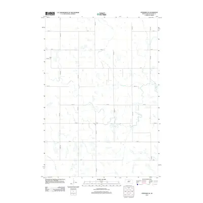
2012 Map of Cresbard SE
USGS Topo · Published 2012About this map
Devoe Cem sits in the northwest quadrant of this rural Faulk County landscape, serving as a primary point of interest for genealogists tracing local families. The terrain is defined by the winding course of the S Fork Snake Cr and its tributary, Perry Cr, which cut through a grid of section lines. This 2012 survey illustrates the enduring agricultural structure of the region, where gravel roads like Co Hwy-8 and 366th Ave provide the framework for the sparsely populated prairie. The map preserves the exact locations of these rural intersections and watercourses before significant modern alterations, offering a clear view of the area's geography as it appeared in the early 21st century.
Find a feature on this map
20 named features on this map. Tap any name to fly to it.
Don’t see what you’re looking for? This feature index may not catch every label — zoom into the map to look around manually.
Map Details
Editions of this 2012 Cresbard SE Map
This is the sole edition of this map. No revisions or reprints were ever made.
Other maps of this area

1899 · Northville
USGS Topo · 1:125,000

1899 · Redfield
USGS Topo · 1:125,000

1953 · Huron
USGS Topo · 1:250,000

1954 · Aberdeen
USGS Topo · 1:250,000

1954 · Huron
USGS Topo · 1:250,000

1956 · Aberdeen
USGS Topo · 1:250,000

1966 · Cresbard SE
USGS Topo · 1:24,000
1966 · Miranda
USGS Topo · 1:24,000
1966 · Northville SW
USGS Topo · 1:24,000
1966 · Chelsea
USGS Topo · 1:24,000