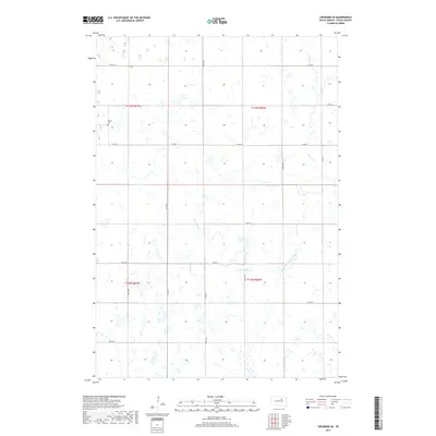
2017 Map of Cresbard SE
USGS Topo · Published 2017About this map
Devoe Cem stands as a focal point for genealogical interest in this prairie landscape, located along the western boundary of Faulk County. This 2017 survey reveals a highly organized township structure dominated by Section lines and rural corridors such as Co Rd 8 and Co Rd 10. The drainage patterns of the South Fork Snake Creek and its tributary S Fork Snake Cr wind through the southern and central sections, while Perry Cr cuts across the northeastern corner. The map reflects a modern agricultural environment defined by its vast wetland basins and the precise Public Land Survey System divisions of townships t119n r67w and t118n r66w. These waterways and rural roads provide the primary framework for understanding the distribution of property and land use in this part of South Dakota.
Find a feature on this map
22 named features on this map. Tap any name to fly to it.
Don’t see what you’re looking for? This feature index may not catch every label — zoom into the map to look around manually.
Map Details
Editions of this 2017 Cresbard SE Map
This is the sole edition of this map. No revisions or reprints were ever made.
Other maps of this area

1899 · Northville
USGS Topo · 1:125,000

1899 · Redfield
USGS Topo · 1:125,000

1953 · Huron
USGS Topo · 1:250,000

1954 · Aberdeen
USGS Topo · 1:250,000

1954 · Huron
USGS Topo · 1:250,000

1956 · Aberdeen
USGS Topo · 1:250,000

1966 · Cresbard SE
USGS Topo · 1:24,000
1966 · Miranda
USGS Topo · 1:24,000
1966 · Northville SW
USGS Topo · 1:24,000
1966 · Chelsea
USGS Topo · 1:24,000