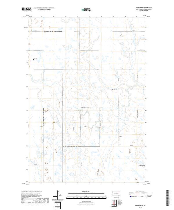
2021 Map of Cresbard SE
USGS Topo · Published 2021About this map
The prairie landscape of Faulk County is defined by the winding course of the South Fork Snake Creek and its tributary S Fork Snake Cr. These drainages, along with Perry Creek in the northeastern corner, are the primary geographical landmarks in a region largely dedicated to agriculture and organized by the Public Land Survey System. The map shows the intersection of four township boundaries, including t119n r67w and t118n r66w, which divide the terrain into a regular grid of sections and mile-line roads.
Find a feature on this map
24 named features on this map. Tap any name to fly to it.
Don’t see what you’re looking for? This feature index may not catch every label — zoom into the map to look around manually.
Map Details
Editions of this 2021 Cresbard SE Map
This is the sole edition of this map. No revisions or reprints were ever made.
Other maps of this area

1899 · Northville
USGS Topo · 1:125,000

1899 · Redfield
USGS Topo · 1:125,000

1953 · Huron
USGS Topo · 1:250,000

1954 · Aberdeen
USGS Topo · 1:250,000

1954 · Huron
USGS Topo · 1:250,000

1956 · Aberdeen
USGS Topo · 1:250,000

1966 · Cresbard SE
USGS Topo · 1:24,000
1966 · Miranda
USGS Topo · 1:24,000
1966 · Northville SW
USGS Topo · 1:24,000
1966 · Chelsea
USGS Topo · 1:24,000