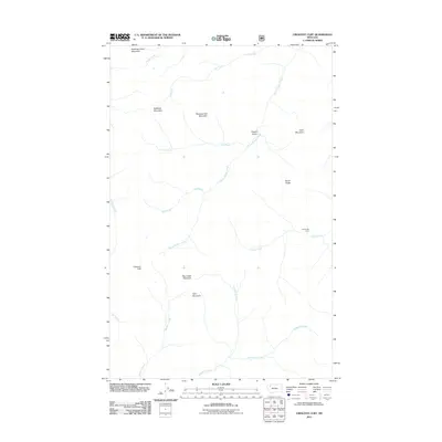
2011 Map of Crescent Cliff
USGS Topo · Published 2011About this map
Running Crane Mountain and Bullshoe Mountain anchor the high northern reaches of this Montana landscape. The terrain is defined by a dense network of high-altitude drainages, where North Badger Creek and its many tributaries, including Pool Creek and Kip Creek, carve through the steep eastern slopes. These waters converge and flow eastward toward the plains, reflecting a classic Rocky Mountain drainage pattern untouched by major modern infrastructure.
Find a feature on this map
21 named features on this map. Tap any name to fly to it.
Don’t see what you’re looking for? This feature index may not catch every label — zoom into the map to look around manually.
Map Details
Editions of this 2011 Crescent Cliff Map
This is the sole edition of this map. No revisions or reprints were ever made.
Other maps of this area

1913 · Marias Pass
USGS Topo · 1:125,000

1958 · Red Plume Mountain
USGS Topo · 1:24,000

1958 · Gable Peaks
USGS Topo · 1:24,000

1958 · Capitol Mountain
USGS Topo · 1:24,000

1958 · Crescent Cliff
USGS Topo · 1:24,000

1960 · Cut Bank
USGS Topo · 1:250,000

1963 · Cut Bank
USGS Topo · 1:250,000

1964 · Cut Bank
USGS Topo · 1:250,000

1968 · Half Dome Crag
USGS Topo · 1:24,000
1968 · Gooseberry Park
USGS Topo · 1:24,000