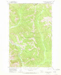
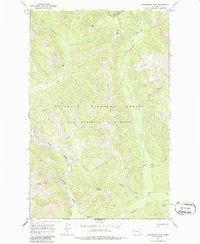
1968 Map of Gooseberry Park
USGS Topo · Published 1972About this map
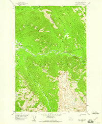
The Continental Divide forms a high-altitude boundary along the northern edge of this wilderness landscape, separating the headwaters of the Middle Fork Flathead River from the eastern slopes. Within the sprawling boundaries of the Bob Marshall Wilderness and the Flathead National Forest, the terrain is defined by a dense network of watercourses including Cox Creek and Strawberry Creek. Human presence is marked primarily by isolated mountain meadows and pack routes, with Wapiti Park, Gooseberry Park, and Grimsley Park providing natural clearings amidst the high peaks. Prominent landmarks such as Bear Peak, Cap Mtn, and Slideout Peak dominate the horizon, illustrating the primitive state of these protected lands in the late 1960s.
Find a feature on this map
24 named features on this map. Tap any name to fly to it.
Don’t see what you’re looking for? This feature index may not catch every label — zoom into the map to look around manually.
Map Details
Editions of this 1968 Gooseberry Park Map
2 editions found
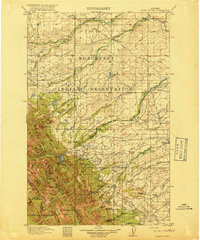
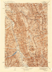
Other maps of this area

1903 · Saypo
USGS Topo · 1:125,000

1913 · Marias Pass
USGS Topo · 1:125,000

1914 · Heart Butte
USGS Topo · 1:125,000
1918 · Heart Butte
USGS Topo · 1:125,000

1936 · Silvertip
USGS Topo · 1:96,000
1942 · Silvertip
USGS Topo · 1:125,000

1955 · Choteau
USGS Topo · 1:250,000

1957 · Choteau
USGS Topo · 1:250,000

1958 · Choteau
USGS Topo · 1:250,000
1958 · Gable Peaks
USGS Topo · 1:24,000