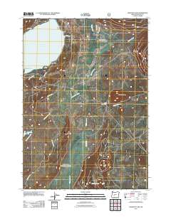
2011 Map of Crescent Lake
USGS Topo · Published 2011About this map
Crescent Lake dominates the upper reaches of this high-elevation terrain, its eastern shore marked by points such as Zims Point and Hoey Point. The landscape is a network of volcanic features and drainage basins, where Big Marsh Creek and Refrigerator Creek flow through the interior. Recreational and agricultural footprints are evident at Simax Group Camp, Camp Makualla, and the JC Collins Ranch, suggesting a long-standing pattern of seasonal use and remote ranching.
Find a feature on this map
22 named features on this map. Tap any name to fly to it.
Don’t see what you’re looking for? This feature index may not catch every label — zoom into the map to look around manually.
Map Details
Editions of this 2011 Crescent Lake Map
This is the sole edition of this map. No revisions or reprints were ever made.
Other maps of this area

1917 · Diamond Lake
USGS Topo · 1:125,000

1925 · Waldo Lake
USGS Topo · 1:125,000

1930 · Maiden Peak
USGS Topo · 1:125,000

1934 · Maiden Peak
USGS Topo · 1:125,000

1935 · Chemult
USGS Topo · 1:96,000

1941 · Chemult
USGS Topo · 1:125,000

1955 · Crescent
USGS Topo · 1:250,000

1956 · Waldo Lake
USGS Topo · 1:62,500

1956 · Summit Lake
USGS Topo · 1:62,500

1957 · Crescent
USGS Topo · 1:250,000