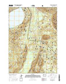
2017 Map of Crescent Lake
USGS Topo · Published 2017About this map
The high Cascade Range defines this portion of the Deschutes National Forest, where the waters of Crescent Lake meet a complex network of forest development roads and volcanic peaks. The northern reaches are dominated by the lake's irregular shoreline, including Simax Bay, Basin Cove, and prominent landmarks like Zims Point and Hoey Point. A transition from open water to high-elevation wetlands occurs to the south, where the expansive Big Marsh is fed by Big Marsh Cr. This landscape is marked by several distinct volcanic features, including Odell Butte, Little Odell Butte, and Beales Butte. The infrastructure reflects the area's management as a recreational and timber resource, with the Crescent Lake Loop W and Windigo Pass Rd providing primary access through the timbered terrain.
Find a feature on this map
44 named features on this map. Tap any name to fly to it.
Don’t see what you’re looking for? This feature index may not catch every label — zoom into the map to look around manually.
Map Details
Editions of this 2017 Crescent Lake Map
This is the sole edition of this map. No revisions or reprints were ever made.
Other maps of this area

1917 · Diamond Lake
USGS Topo · 1:125,000

1925 · Waldo Lake
USGS Topo · 1:125,000

1930 · Maiden Peak
USGS Topo · 1:125,000

1934 · Maiden Peak
USGS Topo · 1:125,000

1935 · Chemult
USGS Topo · 1:96,000

1941 · Chemult
USGS Topo · 1:125,000

1955 · Crescent
USGS Topo · 1:250,000

1956 · Waldo Lake
USGS Topo · 1:62,500

1956 · Summit Lake
USGS Topo · 1:62,500

1957 · Crescent
USGS Topo · 1:250,000