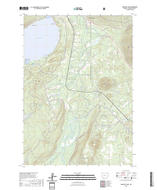
2024 Map of Crescent Lake
USGS Topo · Published 2024About this map
Crescent Lake dominates the northwest corner of this Klamath County landscape, its irregular shoreline defined by Simax Bay, Basin Cove, and Rainbow Cove. This high-altitude terrain in the Cascade Range includes a significant portion of the Deschutes National Forest, where the protected waters of the Crescent Creek Wild and Scenic River and Big Marsh Creek Wild and Scenic River serve as critical hydrologic features. The topography is marked by several prominent volcanic peaks, including Little Odell Butte, Beales Butte, and Chinquapin Butte. A dense network of recreational trails and forest roads, such as the Crescent Lake Loop and Windigo Pass Road, provides access through the Diamond Peak Wilderness, illustrating how this modern-era survey manages remote timber and wilderness lands.
Find a feature on this map
42 named features on this map. Tap any name to fly to it.
Don’t see what you’re looking for? This feature index may not catch every label — zoom into the map to look around manually.
Map Details
Editions of this 2024 Crescent Lake Map
This is the sole edition of this map. No revisions or reprints were ever made.
Other maps of this area

1917 · Diamond Lake
USGS Topo · 1:125,000

1925 · Waldo Lake
USGS Topo · 1:125,000

1930 · Maiden Peak
USGS Topo · 1:125,000

1934 · Maiden Peak
USGS Topo · 1:125,000

1935 · Chemult
USGS Topo · 1:96,000

1941 · Chemult
USGS Topo · 1:125,000

1955 · Crescent
USGS Topo · 1:250,000

1956 · Waldo Lake
USGS Topo · 1:62,500

1956 · Summit Lake
USGS Topo · 1:62,500

1957 · Crescent
USGS Topo · 1:250,000