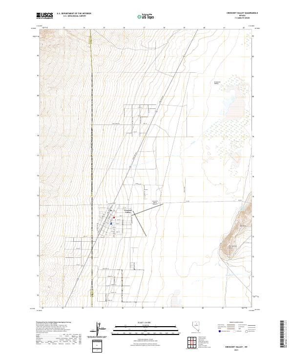
2021 Map of Crescent Valley
USGS Topo · Published 2021About this map
Crescent Valley serves as the central hub of this modern survey, revealing a grid of residential and local streets straddling the Lander and Eureka County line. The settlement is anchored by the Crescent Valley Airport to the east and a network of avenues such as Lander Ave and Tenebo Ave. The landscape to the east is defined by the prominent Hot Springs Point and the adjacent Dry Hills, where geothermal activity is noted at the Crescent Valley Hot Springs. This arid basin environment is intermittently drained by Fire Cr and Thomas Cr, which cross the valley floor toward the eastern marshes. The map documents the persistent layout of this desert community, including named residential clusters like Hillbilly Ln and Rocky Ln, providing a clear record of local infrastructure and natural landmarks.
Find a feature on this map
47 named features on this map. Tap any name to fly to it.
Don’t see what you’re looking for? This feature index may not catch every label — zoom into the map to look around manually.
Map Details
Editions of this 2021 Crescent Valley Map
This is the sole edition of this map. No revisions or reprints were ever made.
Other maps of this area

1949 · Crescent Valley
USGS Topo · 1:62,500

1950 · Crescent Valley
USGS Topo · 1:62,500

1955 · Winnemucca
USGS Topo · 1:250,000

1957 · Frenchie Creek
USGS Topo · 1:62,500

1957 · Dunphy
USGS Topo · 1:62,500

1957 · Beowawe
USGS Topo · 1:62,500

1958 · Winnemucca
USGS Topo · 1:250,000

1962 · Winnemucca
USGS Topo · 1:250,000
1985 · Hand-Me-Down Creek
USGS Topo · 1:24,000

1985 · Mud Spring Gulch
USGS Topo · 1:24,000