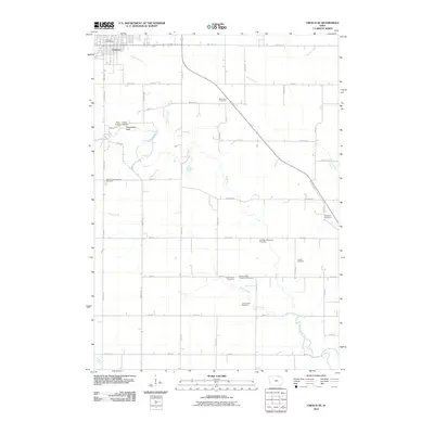
2010 Map of Cresco SE
USGS Topo · Published 2010About this map
The town of Cresco anchors the northwest corner of this agricultural landscape, where the Turkey River and its tributaries, including Otter Creek and Chihaks Creek, carve soft paths through the sectioned farmland of Howard County. A dense concentration of rural burial grounds, such as the Ryan Farm Cemetery, South Kratz Cemetery, and the New Oregon Township Cemetery, speaks to the deep-rooted family farming history and early township organization of this corner of Iowa.
Find a feature on this map
39 named features on this map. Tap any name to fly to it.
Don’t see what you’re looking for? This feature index may not catch every label — zoom into the map to look around manually.
Map Details
Editions of this 2010 Cresco SE Map
This is the sole edition of this map. No revisions or reprints were ever made.
Other maps of this area

1906 · Decorah
USGS Topo · 1:125,000

1954 · Mason City
USGS Topo · 1:250,000

1957 · Mason City
USGS Topo · 1:250,000

1958 · Mason City
USGS Topo · 1:250,000

1958 · La Crosse
USGS Topo · 1:250,000

1961 · La Crosse
USGS Topo · 1:250,000

1965 · La Crosse
USGS Topo · 1:250,000

1975 · Decorah 2 NW
USGS Topo · 1:24,000

1975 · Decorah 3 NW
USGS Topo · 1:24,000

1975 · Decorah 2 SW
USGS Topo · 1:24,000