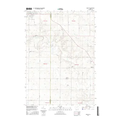
2015 Map of Cresco SE
USGS Topo · Published 2015About this map
Cresco and Ridgeway anchor this portion of the Iowa landscape where the Turkey River winds through the eastern plains. The mapping reveals a densely structured rural environment organized by section lines and township boundaries such as t98n r11w and t98n r10w. A notable concentration of small burial grounds and family plots like the Ryan Farm Cem and Ladwig Farm Cem suggests a long history of local settlement and family land ownership. Religious and community centers are marked by the Saint Johns Lutheran Cem and German Methodist Cem, serving as critical touchstones for genealogists tracing ancestral roots. The hydrology of the region is defined by numerous smaller tributaries including Chihak Cr, Otter Cr, and Walnut Cr, which feed the larger river system near landmarks such as Steamboat Rock.
Find a feature on this map
53 named features on this map. Tap any name to fly to it.
Don’t see what you’re looking for? This feature index may not catch every label — zoom into the map to look around manually.
Map Details
Editions of this 2015 Cresco SE Map
This is the sole edition of this map. No revisions or reprints were ever made.
Other maps of this area

1906 · Decorah
USGS Topo · 1:125,000

1954 · Mason City
USGS Topo · 1:250,000

1957 · Mason City
USGS Topo · 1:250,000

1958 · Mason City
USGS Topo · 1:250,000

1958 · La Crosse
USGS Topo · 1:250,000

1961 · La Crosse
USGS Topo · 1:250,000

1965 · La Crosse
USGS Topo · 1:250,000

1975 · Decorah 2 NW
USGS Topo · 1:24,000

1975 · Decorah 3 NW
USGS Topo · 1:24,000

1975 · Decorah 2 SW
USGS Topo · 1:24,000