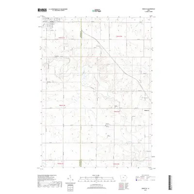
2018 Map of Cresco SE
USGS Topo · Published 2018About this map
The Turkey River and its tributaries, including Otter Cr and Chihaks Cr, carve a complex drainage pattern across this Howard and Winneshiek County landscape. The area is defined by a dense network of rural cemeteries that speak to the region's pioneering settlement and family farming heritage. From the Ryan Farm Cem and Ladwig Farm Cem to the German Methodist Cem and Saint Johns Lutheran Cem, these sites are preserved alongside modern section-line roads like Co HWY a34 and Madison Rd.
Find a feature on this map
60 named features on this map. Tap any name to fly to it.
Don’t see what you’re looking for? This feature index may not catch every label — zoom into the map to look around manually.
Map Details
Editions of this 2018 Cresco SE Map
This is the sole edition of this map. No revisions or reprints were ever made.
Other maps of this area

1906 · Decorah
USGS Topo · 1:125,000

1954 · Mason City
USGS Topo · 1:250,000

1957 · Mason City
USGS Topo · 1:250,000

1958 · Mason City
USGS Topo · 1:250,000

1958 · La Crosse
USGS Topo · 1:250,000

1961 · La Crosse
USGS Topo · 1:250,000

1965 · La Crosse
USGS Topo · 1:250,000

1975 · Decorah 2 NW
USGS Topo · 1:24,000

1975 · Decorah 3 NW
USGS Topo · 1:24,000

1975 · Decorah 2 SW
USGS Topo · 1:24,000