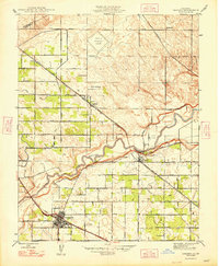
1948 Map of Cressey
USGS Topo · Published 1948About this map
The winding course of the Merced River serves as the central anchor for this agricultural landscape during the late 1940s. Irrigation is the clear lifeblood of the region, evidenced by an intricate network of waterworks including the High Line Canal, Cross Ditch, and El Capitan Canal. These systems support a grid of orchards and fields defined by aromatic road names like Almond Avenue, Walnut Avenue, and Peach Avenue.
Find a feature on this map
38 named features on this map. Tap any name to fly to it.
Don’t see what you’re looking for? This feature index may not catch every label — zoom into the map to look around manually.
Map Details
Editions of this 1948 Cressey Map
2 editions found
Other maps of this area

1913 · Dickenson
USGS Topo · 1:31,680

1916 · Three Tree Flat
USGS Topo · 1:31,680

1916 · Cressey
USGS Topo · 1:31,680

1916 · Montpellier
USGS Topo · 1:31,680

1916 · Denair
USGS Topo · 1:31,680

1917 · Turlock
USGS Topo · 1:31,680

1917 · Winton
USGS Topo · 1:31,680

1918 · Arena
USGS Topo · 1:31,680

1918 · Atwater
USGS Topo · 1:31,680

1918 · Stevinson
USGS Topo · 1:31,680