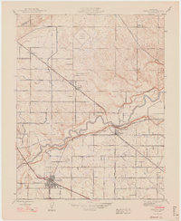
1948 Map of Cressey
USGS Topo · Published 1948About this map
The Merced River meanders through this Central Valley landscape, dividing a meticulously gridded agricultural interior marked by an extensive network of irrigation canals and named avenues. In this mid-century survey, the town of Livingston serves as a primary hub at the junction of the Southern Pacific railroad and major roadways like Walnut Avenue. The map captures the dual-railroad geography of Merced County, with the Atchison Topeka and Santa Fe line cutting diagonally through the settlements of Ballico and Cressey. Local educational and civic life is anchored by rural landmarks such as Barfield Sch and Fruitland Sch, while the northern section features the Turlock Municipal Airport. The intricate naming of thoroughfares, from El Capitan Road to Eucalyptus Avenue, reflects a deeply organized orchard and ranching economy, including properties like the Silver Ann Ranch and the community of Cortez.
Find a feature on this map
35 named features on this map. Tap any name to fly to it.
Don’t see what you’re looking for? This feature index may not catch every label — zoom into the map to look around manually.
Map Details
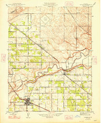
Editions of this 1948 Cressey Map
2 editions found
Other maps of this area

1913 · Dickenson
USGS Topo · 1:31,680

1916 · Three Tree Flat
USGS Topo · 1:31,680

1916 · Cressey
USGS Topo · 1:31,680

1916 · Montpellier
USGS Topo · 1:31,680

1916 · Denair
USGS Topo · 1:31,680

1917 · Turlock
USGS Topo · 1:31,680

1917 · Winton
USGS Topo · 1:31,680

1918 · Arena
USGS Topo · 1:31,680

1918 · Atwater
USGS Topo · 1:31,680

1918 · Stevinson
USGS Topo · 1:31,680