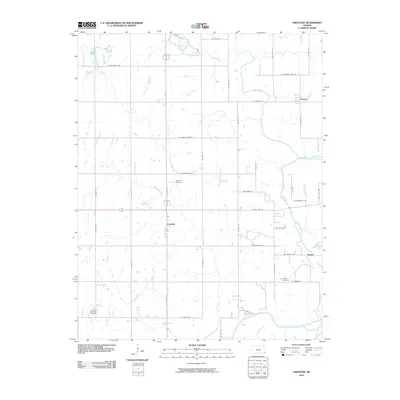
2010 Map of Crestline
USGS Topo · Published 2010About this map
The settlement of Crestline anchors this portion of Cherokee County, situated along the north-south corridor of US Highway 69. The landscape is defined by the drainage systems of Shawnee Creek and Little Shawnee Creek, which flow toward the more substantial Spring River in the southeast. This area of southeast Kansas reflects a quiet rural character where local history is preserved in small communal hubs and family resting places. For genealogists and local historians, the presence of several established burial grounds provides significant research value, including the Wirtonia Cemetery near the center of the sheet and Messer Cemetery further south. The Timberhill Oak Hill Cemetery occupies the southwestern corner, serving as a landmark for the surrounding farmland. To the east and northeast, the small communities of Badger and Lawton mark the intersections of a grid-like road network, while Cow Creek and Long Branch traverse the northern agricultural tracts.
Find a feature on this map
26 named features on this map. Tap any name to fly to it.
Don’t see what you’re looking for? This feature index may not catch every label — zoom into the map to look around manually.
Map Details
Editions of this 2010 Crestline Map
This is the sole edition of this map. No revisions or reprints were ever made.
Other maps of this area

1886 · Joplin
USGS Topo · 1:125,000

1894 · Joplin
USGS Topo · 1:125,000

1918 · Columbus
USGS Topo · 1:62,500

1943 · Cherokee
USGS Topo · 1:62,500

1945 · Pittsburg
USGS Topo · 1:62,500

1945 · Cherokee
USGS Topo · 1:62,500

1947 · Joplin
USGS Topo · 1:250,000

1947 · Pittsburg
USGS Topo · 1:62,500

1949 · Joplin
USGS Topo · 1:250,000

1950 · Pittsburg
USGS Topo · 1:62,500