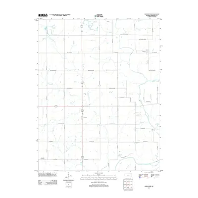
2012 Map of Crestline
USGS Topo · Published 2012About this map
The Crestline settlement serves as a central point in this Cherokee County landscape, where the agricultural grid is defined by a dense network of country roads. Waterways like Shawnee Cr and Little Shawnee Cr cut through the terrain, eventually feeding toward the larger Spring River to the southeast. For those researching local family history, the map provides precise locations for several burial grounds, including Wirtonia Cem north of the main crossroads and the uniquely named Timberhill Oak Hill Cem in the southwestern quadrant. Smaller clusters of development at Lawton and Badger show the persistent rural community structure of southeastern Kansas into the early 21st century. The map traces the paths of primary transit corridors like NE Old Highway 96, reflecting the evolution of regional transportation from historic thoroughfares to modern county infrastructure.
Find a feature on this map
46 named features on this map. Tap any name to fly to it.
Don’t see what you’re looking for? This feature index may not catch every label — zoom into the map to look around manually.
Map Details
Editions of this 2012 Crestline Map
This is the sole edition of this map. No revisions or reprints were ever made.
Other maps of this area

1886 · Joplin
USGS Topo · 1:125,000

1894 · Joplin
USGS Topo · 1:125,000

1918 · Columbus
USGS Topo · 1:62,500

1943 · Cherokee
USGS Topo · 1:62,500

1945 · Pittsburg
USGS Topo · 1:62,500

1945 · Cherokee
USGS Topo · 1:62,500

1947 · Joplin
USGS Topo · 1:250,000

1947 · Pittsburg
USGS Topo · 1:62,500

1949 · Joplin
USGS Topo · 1:250,000

1950 · Pittsburg
USGS Topo · 1:62,500