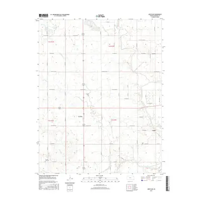
2015 Map of Crestline
USGS Topo · Published 2015About this map
Crestline serves as a central hub in this section of Cherokee County, where the agricultural landscape is defined by a grid of section-line roads and the winding path of Shawnee Creek. This region, documented in the mid-2010s, maintains a character rooted in small settlements like Lawton and Badger. The map reveals the area's social history through several burial grounds, including Wirtonia Cem near the center and the Timberhill Oak Hill Cem in the southwest corner. The eastern portion of the quadrangle is dominated by the Spring River, which creates a more varied riparian environment compared to the surrounding farm tracts. The persistence of names like Messer Cem and the complex drainage system of Cow Creek and Little Shawnee Cr reflect a landscape where natural waterways and family-named landmarks still dictate the local geography.
Find a feature on this map
48 named features on this map. Tap any name to fly to it.
Don’t see what you’re looking for? This feature index may not catch every label — zoom into the map to look around manually.
Map Details
Editions of this 2015 Crestline Map
This is the sole edition of this map. No revisions or reprints were ever made.
Other maps of this area

1886 · Joplin
USGS Topo · 1:125,000

1894 · Joplin
USGS Topo · 1:125,000

1918 · Columbus
USGS Topo · 1:62,500

1943 · Cherokee
USGS Topo · 1:62,500

1945 · Pittsburg
USGS Topo · 1:62,500

1945 · Cherokee
USGS Topo · 1:62,500

1947 · Joplin
USGS Topo · 1:250,000

1947 · Pittsburg
USGS Topo · 1:62,500

1949 · Joplin
USGS Topo · 1:250,000

1950 · Pittsburg
USGS Topo · 1:62,500