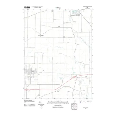
2010 Map of Crestline
USGS Topo · Published 2010About this map
Crestline serves as a central hub on this 2010 map, situated where long-established road networks and drainage patterns of the Black Fork Mohican River converge. The area displays a dense concentration of historical burial grounds, including Saint Josephs Cemetery, Green Lawn Cemetery, and the Riblet Cemetery, which provide vital touchpoints for genealogical research in this part of Crawford County. Small rural settlements like Bethlehem and Vernon Junction remain distinct landmarks amidst a landscape defined by water management and aviation, featuring the Crestline Reservoir and proximity to the Galion Municipal Airport. These infrastructure elements, alongside Walton Lake, illustrate the region's development of water resources to support the local population and industry. The presence of Shafers Hollow and Ralston Knob adds topographical variation to the otherwise orderly grid of country roads like the Lincoln Hwy.
Find a feature on this map
51 named features on this map. Tap any name to fly to it.
Don’t see what you’re looking for? This feature index may not catch every label — zoom into the map to look around manually.
Map Details
Editions of this 2010 Crestline Map
This is the sole edition of this map. No revisions or reprints were ever made.
Other maps of this area

1913 · Mount Gilead
USGS Topo · 1:62,500

1915 · Bucyrus
USGS Topo · 1:62,500

1915 · Crestline
USGS Topo · 1:62,500

1915 · Shauck
USGS Topo · 1:62,500

1916 · Mount Gilead
USGS Topo · 1:62,500

1943 · Shauck
USGS Topo · 1:62,500

1943 · Bucyrus
USGS Topo · 1:62,500

1943 · Crestline
USGS Topo · 1:62,500

1943 · Mount Gilead
USGS Topo · 1:62,500

1950 · Marion
USGS Topo · 1:250,000