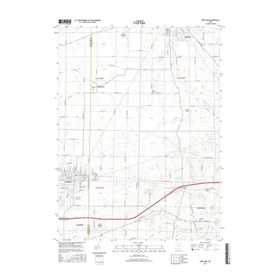
2016 Map of Crestline
USGS Topo · Published 2016About this map
The Crawford and Richland County line bisects this landscape, marking a transition between the established industrial hubs of Shelby and Galion. The era is defined by significant water management infrastructure, most notably the Shelby Upground Reservoir Number One and Shelby Upground Reservoir Number Two, alongside the Crestline Reservoir. These features, coupled with Walton Lake, illustrate the region's mid-century focus on securing municipal water supplies as the surrounding towns expanded. For genealogists, the map is remarkably dense with burial grounds, including the Bethlehem, Coltman, and German Reform cemeteries, which speak to the area's early German settlement history. The terrain is largely agricultural, broken by the winding Black Fork Mohican River and the distinct elevation of Ralston Knob near Ontario. Transport remains central to the area's identity, with the CSX rail line and two municipal airports facilitating movement through this northern Ohio corridor.
Find a feature on this map
132 named features on this map. Tap any name to fly to it.
Don’t see what you’re looking for? This feature index may not catch every label — zoom into the map to look around manually.
Map Details
Editions of this 2016 Crestline Map
This is the sole edition of this map. No revisions or reprints were ever made.
Other maps of this area

1913 · Mount Gilead
USGS Topo · 1:62,500

1915 · Bucyrus
USGS Topo · 1:62,500

1915 · Crestline
USGS Topo · 1:62,500

1915 · Shauck
USGS Topo · 1:62,500

1916 · Mount Gilead
USGS Topo · 1:62,500

1943 · Shauck
USGS Topo · 1:62,500

1943 · Bucyrus
USGS Topo · 1:62,500

1943 · Crestline
USGS Topo · 1:62,500

1943 · Mount Gilead
USGS Topo · 1:62,500

1950 · Marion
USGS Topo · 1:250,000