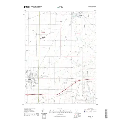
2019 Map of Crestline
USGS Topo · Published 2019About this map
Crestline and its surrounding communities occupy a strategic position along the border of Crawford and Richland counties, illustrating the dense civil and hydrological infrastructure of modern north-central Ohio. The landscape is punctuated by water management projects including the Shelby Upground Reservoir Number One and Shelby Upground Reservoir Number Two in the north, alongside the Crestline Reservoir and Walton Lake further south. These artificial water bodies contrast with the natural meandering paths of the Black Fork Mohican River and Paramour Cr, which define the local drainage patterns near Ontario.
Find a feature on this map
126 named features on this map. Tap any name to fly to it.
Don’t see what you’re looking for? This feature index may not catch every label — zoom into the map to look around manually.
Map Details
Editions of this 2019 Crestline Map
This is the sole edition of this map. No revisions or reprints were ever made.
Other maps of this area

1913 · Mount Gilead
USGS Topo · 1:62,500

1915 · Bucyrus
USGS Topo · 1:62,500

1915 · Crestline
USGS Topo · 1:62,500

1915 · Shauck
USGS Topo · 1:62,500

1916 · Mount Gilead
USGS Topo · 1:62,500

1943 · Shauck
USGS Topo · 1:62,500

1943 · Bucyrus
USGS Topo · 1:62,500

1943 · Crestline
USGS Topo · 1:62,500

1943 · Mount Gilead
USGS Topo · 1:62,500

1950 · Marion
USGS Topo · 1:250,000