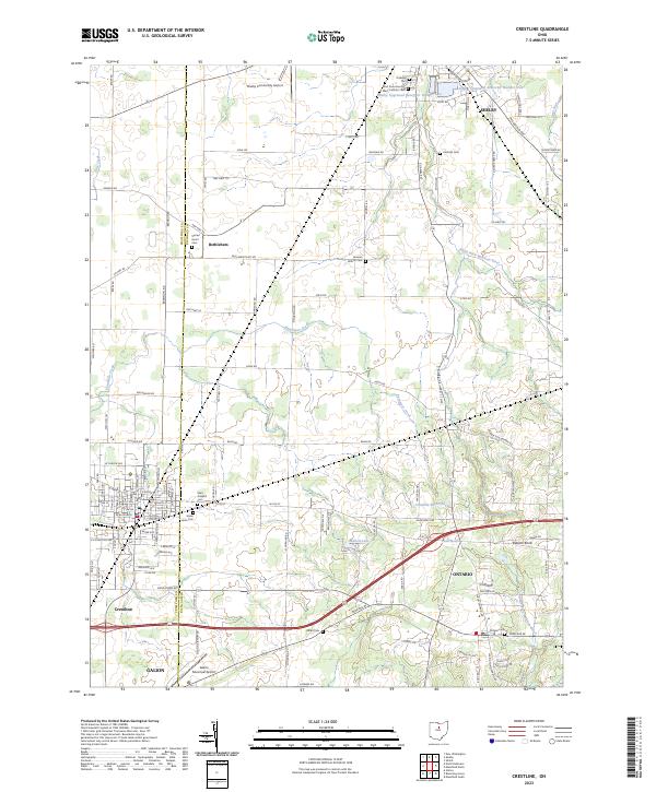
2023 Map of Crestline
USGS Topo · Published 2023About this map
Crestline sits at the junction of the Crawford Co and Richland Co border, serving as a focal point for this rural landscape transitioning between small industrial centers. The geography is defined by the headwaters of Paramour Creek and the Black Fork Mohican River, which cut through the agricultural tablelands. Notable for genealogists, the map identifies numerous burial sites including the Saint Josephs Cem, Riblet Cem, and Green Lawn Cem. Small agrarian communities like Bethlehem and the outlying residential growth of Shelby and Ontario are visible, alongside infrastructure such as the Shelby Community Airport and the Galion Municipal Airport. Significant water features like the Shelby Upground Reservoir Number One and Walton Lake highlight the region's managed water resources for its municipal populations.
Find a feature on this map
122 named features on this map. Tap any name to fly to it.
Don’t see what you’re looking for? This feature index may not catch every label — zoom into the map to look around manually.
Map Details
Editions of this 2023 Crestline Map
This is the sole edition of this map. No revisions or reprints were ever made.
Other maps of this area

1913 · Mount Gilead
USGS Topo · 1:62,500

1915 · Bucyrus
USGS Topo · 1:62,500

1915 · Crestline
USGS Topo · 1:62,500

1915 · Shauck
USGS Topo · 1:62,500

1916 · Mount Gilead
USGS Topo · 1:62,500

1943 · Shauck
USGS Topo · 1:62,500

1943 · Bucyrus
USGS Topo · 1:62,500

1943 · Crestline
USGS Topo · 1:62,500

1943 · Mount Gilead
USGS Topo · 1:62,500

1950 · Marion
USGS Topo · 1:250,000