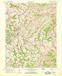
1960 Map of Crestwood
USGS Topo · Published 1969About this map
Floyds Fork meanders through the central landscape of this 1960 revision, defining the geography of southern Oldham County as it nears the borders of Jefferson and Shelby counties. The Louisville and Nashville railroad serves as the primary corridor for regional growth, connecting established communities like Crestwood and Pewee Valley. Local institutional history is anchored by landmarks such as the Pewee Valley Sanitarium and Kavanaugh Camp, while the presence of State Prison Water utility indicates the specialized infrastructure of the era. Genealogists will find significant value in the distribution of rural burial sites and congregations, including Pleasant Hill Cem and Long Run Ch. Small agrarian crossroads like Centerfield, Glenarm, and Floydsburg reflect the early-century settlement patterns that persisted even as the area began to modernize.
Find a feature on this map
51 named features on this map. Tap any name to fly to it.
Don’t see what you’re looking for? This feature index may not catch every label — zoom into the map to look around manually.
Map Details
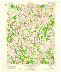
Editions of this 1960 Crestwood Map
2 editions found
Other maps of this area

1905 · Prospect
USGS Topo · 1:62,500

1907 · Louisville
USGS Topo · 1:62,500

1912 · Prospect
USGS Topo · 1:62,500

1929 · Taylorsville
USGS Topo · 1:62,500

1932 · La Grange
USGS Topo · 1:62,500

1938 · Owen
USGS Topo · 1:24,000

1948 · Owen
USGS Topo · 1:24,000

1951 · Anchorage
USGS Topo · 1:24,000

1951 · Crestwood
USGS Topo · 1:24,000

1951 · Jeffersontown
USGS Topo · 1:24,000