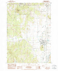
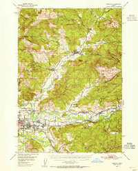
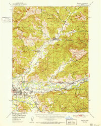
1984 Map of Creswell
USGS Topo · Published 1984About this map
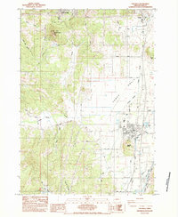
Creswell and Goshen anchor the Willamette Valley floor in this 1980s snapshot of Lane County, where the valley begins to transition into the upland ridges of Spencer Butte. The landscape is defined by the Southern Pacific rail line and a network of rural roads such as Dillard Road and Rickett Road that connect agricultural tracts to the growing population centers. To the west, the Moxley Cem and Spencer Butte Park offer clues for genealogists and local historians tracking early settlement patterns and the preservation of natural landmarks. The drainage of Camas Swale Creek and Hill Creek toward the Coast Fork Willamette River illustrates the hydrology that dictated the development of the valley's irrigation and industrial sites, including a Quarry and the Creswell Airport.
Find a feature on this map
32 named features on this map. Tap any name to fly to it.
Don’t see what you’re looking for? This feature index may not catch every label — zoom into the map to look around manually.
Map Details
Editions of this 1984 Creswell Map
2 editions found
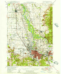
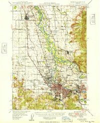
Other maps of this area

1910 · Eugene
USGS Topo · 1:62,500

1921 · Cottage Grove
USGS Topo · 1:62,500

1935 · Lowell
USGS Topo · 1:96,000

1940 · Eugene
USGS Topo · 1:62,500

1942 · Lowell
USGS Topo · 1:125,000
1946 · Eugene
USGS Topo · 1:62,500
1949 · Eugene
USGS Topo · 1:62,500
1950 · Marcola
USGS Topo · 1:62,500
1952 · Marcola
USGS Topo · 1:62,500

1953 · Salem
USGS Topo · 1:250,000