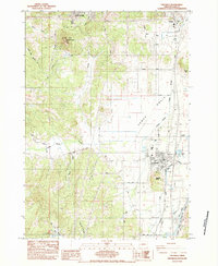
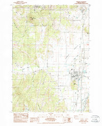
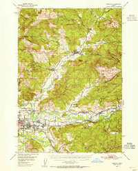
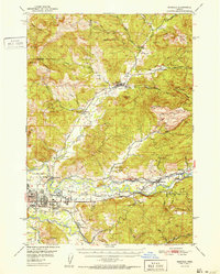
1984 Map of Creswell
USGS Topo · Published 1988About this map
Creswell and Goshen anchor this 1980s landscape south of Eugene, where the Willamette Valley floor meets the foothills of the Coast Range. The Southern Pacific railroad line defines the north-south transport corridor, paralleling the Coast Fork Willamette River and passing near the local Creswell Airport. Notable landmarks include the prominent Spencer Butte and its namesake Spencer Butte Park in the northwest, while Creswell Butte rises just south of the town center. The map captures a detailed drainage network, with Camas Swale Creek and Amazon Creek carving through the terrain. Genealogists will find the Moxley Cem and numerous family-named roads like Dillard Road and Christensen Road, reflecting the area's established rural settlement patterns and local industry shown via several quarries and gravel pits.
Find a feature on this map
35 named features on this map. Tap any name to fly to it.
Don’t see what you’re looking for? This feature index may not catch every label — zoom into the map to look around manually.
Map Details
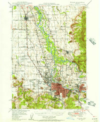
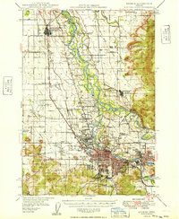
Editions of this 1984 Creswell Map
2 editions found
Other maps of this area

1910 · Eugene
USGS Topo · 1:62,500

1921 · Cottage Grove
USGS Topo · 1:62,500

1935 · Lowell
USGS Topo · 1:96,000

1940 · Eugene
USGS Topo · 1:62,500

1942 · Lowell
USGS Topo · 1:125,000
1946 · Eugene
USGS Topo · 1:62,500
1949 · Eugene
USGS Topo · 1:62,500
1950 · Marcola
USGS Topo · 1:62,500
1952 · Marcola
USGS Topo · 1:62,500

1953 · Salem
USGS Topo · 1:250,000