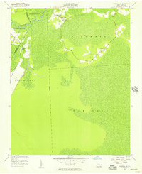
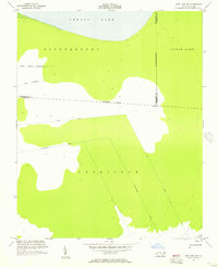
1954 Map of Creswell SE
USGS Topo · Published 1957About this map
Scuppernong River flows through the upper corner of this coastal plain landscape, where the flat terrain of Columbia and Gum Neck is defined by a systematic network of drainage works. Extensive waterways like the Thirty-Foot Canal, Bonanza Canal, and Old Canal illustrate the mid-century effort to manage the low-lying wetlands for agriculture or timber. Small, dispersed settlements appear at Ballast Bank, Cross Landing, and New Lands, each marked by local spiritual centers including Holly Grove Ch and Cross Landing Ch.
Find a feature on this map
21 named features on this map. Tap any name to fly to it.
Don’t see what you’re looking for? This feature index may not catch every label — zoom into the map to look around manually.
Map Details
Editions of this 1954 Creswell SE Map
2 editions found
Other maps of this area

1943 · Columbia
USGS Topo · 1:125,000

1953 · Columbia East
USGS Topo · 1:24,000

1953 · Scotia
USGS Topo · 1:24,000

1953 · Columbia West
USGS Topo · 1:24,000

1953 · Fairfield NW
USGS Topo · 1:24,000

1953 · Rocky Mount
USGS Topo · 1:250,000

1954 · Rocky Mount
USGS Topo · 1:250,000
1954 · Creswell
USGS Topo · 1:24,000
1954 · New Lake
USGS Topo · 1:24,000
1954 · New Lake NW
USGS Topo · 1:24,000