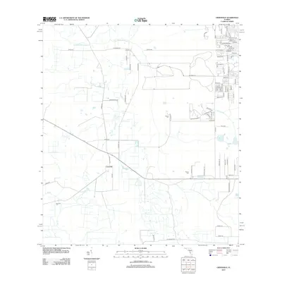
2012 Map of Crewsville
USGS Topo · Published 2012About this map
Crewsville stands as the central community of this Florida interior landscape, characterized by a sparse network of country roads and low-lying watercourses. Several family and community burial grounds are established throughout the area, including Oak Creek Cem, Prescott Cem, and Whitten Cem, providing significant points of interest for genealogical research. The local geography is defined by meandering creek systems such as Little Charley Bowlegs Cr, Oak Cr, and Haw Branch, which dictate the placement of roads like N Hammock Rd and S Hammock Rd. While residential subdivisions appear in the northeast corner near Blue Lake, much of the quadrangle retains its rural character, with a grid of secondary roads such as Skipper Rd and Parnell Rd connecting disparate properties and agricultural lands.
Find a feature on this map
86 named features on this map. Tap any name to fly to it.
Don’t see what you’re looking for? This feature index may not catch every label — zoom into the map to look around manually.
Map Details
Editions of this 2012 Crewsville Map
This is the sole edition of this map. No revisions or reprints were ever made.
Other maps of this area

1952 · Lake Arbuckle SW
USGS Topo · 1:24,000

1952 · Sebring
USGS Topo · 1:24,000

1953 · Avon Park
USGS Topo · 1:24,000

1953 · Lake June In Winter
USGS Topo · 1:24,000

1953 · Crewsville SE
USGS Topo · 1:24,000

1953 · Crewsville
USGS Topo · 1:24,000

1956 · Sweetwater
USGS Topo · 1:24,000

1956 · Crewsville SW
USGS Topo · 1:24,000

1956 · Griffins Corner
USGS Topo · 1:24,000

1956 · Fort Pierce
USGS Topo · 1:250,000