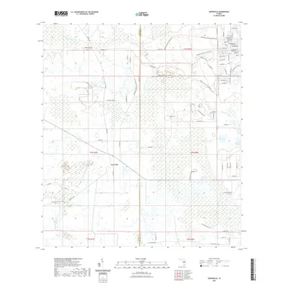
2021 Map of Crewsville
USGS Topo · Published 2021About this map
Crewsville stands as a focal point in this south-central Florida landscape, where the boundary between Hardee and Highlands counties cuts through a terrain defined by citrus groves and conservation lands. The eastern portion of the survey is dominated by the Lake Wales Ridge, a distinctive sandy upland that hosts the Highlands Hammock State Park Trl. This area is characterized by an intricate network of equestrian and hiking paths, including the Highlands Hammock Equestrian Trl, indicating the region's shift toward recreational land use and preservation.
Find a feature on this map
62 named features on this map. Tap any name to fly to it.
Don’t see what you’re looking for? This feature index may not catch every label — zoom into the map to look around manually.
Map Details
Editions of this 2021 Crewsville Map
This is the sole edition of this map. No revisions or reprints were ever made.
Other maps of this area

1952 · Lake Arbuckle SW
USGS Topo · 1:24,000

1952 · Sebring
USGS Topo · 1:24,000

1953 · Avon Park
USGS Topo · 1:24,000

1953 · Lake June In Winter
USGS Topo · 1:24,000

1953 · Crewsville SE
USGS Topo · 1:24,000

1953 · Crewsville
USGS Topo · 1:24,000

1956 · Sweetwater
USGS Topo · 1:24,000

1956 · Crewsville SW
USGS Topo · 1:24,000

1956 · Griffins Corner
USGS Topo · 1:24,000

1956 · Fort Pierce
USGS Topo · 1:250,000