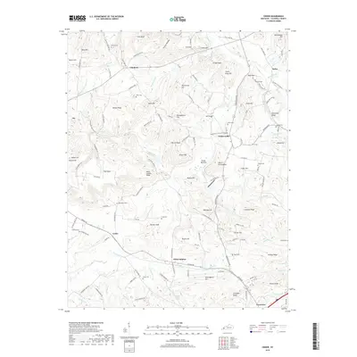
2019 Map of Crider
USGS Topo · Published 2019About this map
White Sulphur Spring and the nearby community of White Sulphur anchor this map of western Kentucky's ridge country. The landscape is defined by a dense network of creek branches and named hills, illustrating a rural settlement pattern where life centered on small crossroads like Farmersville and Crider. Genealogists will find a high concentration of family burial sites scattered across the ridges, including Asher Cem, Calvert Cem, and Rowland Cem, which likely mark the original homesteads of early settlers in this part of Caldwell County. The terrain is marked by significant elevation changes from the lowlands of Tucker Bottoms to the heights of Black Sulphur Ridge and Farmer Knob. Along the northern edge, the community of Flat Rock and features like Ditney Ridge show how topographic landmarks historically dictated the placement of roads and farms in this region.
Find a feature on this map
135 named features on this map. Tap any name to fly to it.
Don’t see what you’re looking for? This feature index may not catch every label — zoom into the map to look around manually.
Map Details
Editions of this 2019 Crider Map
This is the sole edition of this map. No revisions or reprints were ever made.
Other maps of this area

1908 · Princeton
USGS Topo · 1:62,500

1909 · Providence
USGS Topo · 1:62,500

1910 · Princeton
USGS Topo · 1:62,500

1916 · Fords Ferry
USGS Topo · 1:62,500

1921 · Fords Ferry
USGS Topo · 1:48,000

1925 · Cave In Rock
USGS Topo · 1:62,500

1928 · Eddyville
USGS Topo · 1:48,000

1931 · Eddyville
USGS Topo · 1:62,500

1936 · Eddyville
USGS Topo · 1:48,000

1949 · Paducah
USGS Topo · 1:250,000