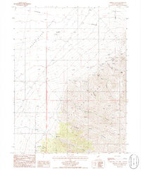
1985 Map of Crippen Canyon
USGS Topo · Published 1986About this map
The Shoshone Range rises sharply above the Reese River Valley in this mid-1980s provisional study, revealing a landscape defined by its mining heritage. The map documents extensive underground workings, including the Betty O' Neal Mine, several named Tunnels, and a series of Mineshaft and Prospects scattered across the eastern slopes. A notable historical feature is the Old Railroad Grade running through the northern valley, marking the path of former transportation infrastructure that once served the remote district of Lewis. High-altitude terrain is anchored by Lewis Peak, which overlooks a rugged network of drainage systems such as Whisky Canyon, Rocky Canyon, and Crippen Canyon. The drainage of Trout Creek and Hancock Canyon provide geographical context to the southern portion of the quadrangle, illustrating the complex relationship between mining claims and natural water sources in this arid environment.
Find a feature on this map
23 named features on this map. Tap any name to fly to it.
Don’t see what you’re looking for? This feature index may not catch every label — zoom into the map to look around manually.
Map Details
Editions of this 1985 Crippen Canyon Map
This is the sole edition of this map. No revisions or reprints were ever made.
Other maps of this area

1932 · Sonoma Range
USGS Topo · 1:250,000

1939 · Sonoma Range
USGS Topo · 1:250,000

1940 · Antler Peak
USGS Topo · 1:62,500

1943 · Antler Peak
USGS Topo · 1:62,500

1949 · Mt. Lewis
USGS Topo · 1:62,500

1950 · Mt. Lewis
USGS Topo · 1:62,500

1955 · Winnemucca
USGS Topo · 1:250,000

1957 · Battle Mountain
USGS Topo · 1:62,500

1958 · Winnemucca
USGS Topo · 1:250,000

1961 · McCoy
USGS Topo · 1:62,500